Wisconsin Waterfalls, Spillways & Rapids


 Strong Falls  Superior Falls Cascade Falls Big Falls 12 Foot Falls Amnicon Falls Interstate Falls Snake Pit Falls

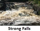
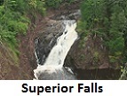
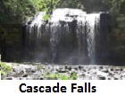
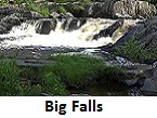
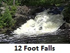
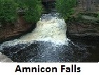
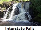
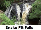
Shown above are just a few of the over 1000 documented Wisconsin waterway sites.  We have the most comprehensive website in Wisconsin documenting waterfalls, spillways and rapids.  Listed here are our other websites and books which provide massive information:
 

Our Wisconsin Waterfalls Travel Guide 2022 edition provides the following information:
County by county listing of 354 waterfall sites (our 2018 book of 185 waterfalls is now out of print)... 316 listings contain a color photograph of the site
(38 sites do not have photos because they are on private land, Indian land or inaccessible); 353 listings provide the exact GPS coordinates; most listings provide the estimated total height of the falls and the highest single drop, all listings provide the type of access (public, private, Indian, etc.); and the guide provides detailed descriptions on how to use the guide using "Google Earth" and GPS coordinates.
  Our $14.95 Wisconsin Waterfalls Travel Guide 2022
edition of 
354 waterfalls is now available at dealers all over Wisconsin... Click Here for guide details and the list of Wisconsin dealers
(visit a bookstore to see the guide up close and personal, or Click Here to order on-line).  Other waterfall guides exist... Click Here to read a review of other known guides.
 

 Click Here for our FREE website that provides extensive information:
   1. County maps showing locations of 353 waterfalls in our 2022 waterfall guide book... how to prepare to visit a site (helpful hints... what to take
          and tips to stay safe)... legal discussion of walking up a stream using the Wisconsin DNR "keep your feet wet" procedure... alphabetical list of
          all sites found thru the end of 2021 (359 waterfalls, 451 spillways and 216 rapids)... legality of visiting Indian land... a list and links to other
          waterfall sites... a "blog" discussing site visits... how to determine if a site is a "waterfall" or a "rapid"... we pay money to those helping us
          find new sites (see our list of supporting contributors).
   2. The "free" site lists one county in its entirety from the "membership site" so you can see the value of joining the membership site.
   3. The "free" site contains a listing of all new waterfalls, spillways, and rapids that have been found after the 2022 book went to press (but it is a listing
        only... details of the newly found sites are shown only on the "membership site").
 

Our "WisconsinWaterfallsPlus" $1 a month membership website provides the following additional information:
   1. Complete details about 385 waterfalls, 457 spillways and 219 rapids... color photos and color video with sound of most sites, including exact GPS
          coordinates of each sites.  Before deciding to visit a site, it is extremely helpful to see the video first and determine if the site is worth a visit!
   2. Complete driving directions to each site.
   2. Complete details about new waterfalls, spillways and rapids added in 2022 (thru September of 2022 we have added 26 new falls, 6 new spillways,
        and 3 new rapids
... new site locations and data are shown only on the membership site).
   3. Three new information items have been added to all waterfall sites... (1) the estimated height of the falls, (2) the subjective difficulty to access the
          area... rated from 1 to 10 (if you need a rope to see the falls it is automatically rated a difficulty "10"), and (3) an estimate of how long it takes to
          walk to the falls and back in minutes.
   4. Click Here to join our $1 a month "WisconsinWaterfallsPlus" membership website.  Click Here to login after joining.  Click Here if you forgot login code.


Copyright © 2015-2022 Miriah Systems LLC. The Copyright and "All rights reserved" applies to all pages of this website.
Data, photos, and/or video on this web site may not be reproduced in whole or in part in any manner (read "Legal Stuff").

This website is casual informational only.  No representation is made or warranty given as to its content.  User assumes all risk for use of all information on this website.
The Lat-Long GPS coordinates shown are not guaranteed and we assume no responsibility for any loss or delay resulting from use.

eMail: waterfallswisconsin@gmail.com